What Is a GPS Module?
 A GPS module is a device that receives GPS signals transmitted from a large number of satellites in space and determines location information.
GPS is an acronym for “global positioning system,” a system that can provide precise location information for the entire world. If accurate location information can be obtained from a GPS module, it is possible to calculate the speed and direction in which you are currently moving, as well as the distance to your destination.
GPS is a satellite positioning system operated in the United States, but Japan has its own satellite positioning system called MICHIBIKI, which can correct GPS information.
Uses of GPS Modules
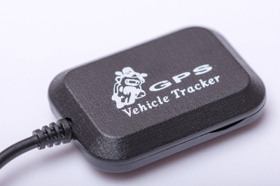
GPS modules are used for positioning applications for devices that require motion, location information, travel speed, direction, etc.
Specific uses of GPS modules include the following:
- Position observation for use with map applications in smartphones and smartwatches
- Calculation of vehicle position, speed, direction, and distance to destination in car navigation systems
Depending on the product specifications of the GPS module, it is important to select a GPS module taking into consideration how much the position accuracy, calculation time, and degree of error in position information affect the product.
If there are obstructions to the GPS signal, such as being underground or buildings, the signal may not be received accurately. Some high-precision GPS modules are capable of receiving signals by processing signals made smaller by shielding.
Principle of GPS Modules
The principle of a GPS module is that it has a signal processing algorithm that receives GPS signals from satellites, processes and analyzes the signals, and calculates the module’s current position. The GPS signal to calculate accurate position information is processed by detecting and amplifying the weak signal and performing RF processing and baseband processing.
Each product has its own algorithm for processing GPS signals in order to improve position detection accuracy and reduce current consumption. GPS signals emitted from satellites are generally transmitted on two different frequencies. The signal contains the time of day when the signal is transmitted and the exact location of the satellite at that time.
The GPS signal is received by the receiver of the GPS module, which receives signals from four or more satellites. The GPS signals allow the distance from the satellites to be calculated, and if the distance from the three satellites is known, the current position on the earth can be calculated.
The fourth and subsequent satellites are used to adjust for time errors and help calculate more precise location information.
Other Information About the GPS Module
1. Frequencies Handled by the GPS Module
GPS modules usually operate in the L1 band (1575.42 MHz) and the L2 band (1227.6 MHz), and sometimes in the L5 band (1176.45 MHz).
The L1 band contains both a civilian identification code called the C/A code and a military code called the P code, with the C/A code usually used.
2. Positional Accuracy of GPS
Various factors affect the accuracy of a GPS module’s measurements, but the main sources of error are:
Ionosphere
A layer in the atmosphere that slows down GPS satellite signals as they pass through it, causing errors.
Troposphere
This is another layer in the atmosphere. The refraction of radio waves in the dry atmosphere and in water vapor causes errors.
Multibus
When radio waves emitted from GPS satellites are received, they are reflected by various objects such as the ground and structures. This phenomenon, called multipath, disturbs the radio waves and causes errors.
Of these, multipath is the most significant error factor because it limits the number of satellites that can be received and their placement among the satellites. The error varies depending on the performance of the GPS module itself, but a typical device equipped with a GPS module will have an error of about 10 meters in a good reception environment and about 100 meters in a poor reception environment.
However, smartphones have Wi-Fi, time correction, application location systems, and other systems that correct GPS, so using them together can further improve positional accuracy.
3. The Japanese Satellite Positioning System “MICHIBIKI”
To make GPS modules more accurate and stable reception, there is currently a Japanese satellite positioning system called MICHIBIKI, which has been in operation with four satellites since November 2018. Satellite positioning is possible with more than four satellites, but for stability, it is desirable to have more satellites visible.
MICHIBIKI, which is called the Japanese version of GPS, provides stable and highly accurate positioning by compensating for points where conventional GPS satellites’ signals are blocked and location information becomes unstable.